
The Manigotagan River
Last update=9 Feb, 98
The Rite of Spring for paddlers in southern Manitoba -- a 3-day trip on the Manigotagan on the May long weekend. The river becomes free of ice in early May, and spring run-off usually peaks around May 15 to 25. The trip usually starts at Caribou Lodge on Quesnel Lake. Three days of paddling takes you back to highway 304. Arrange with the folks at Caribou Lodge to shuttle your car to the take-out. Start at Long Lake or the bridge on highway 314 for a 5 day trip.
The Manigotagan River has its headwaters in Woodland Caribou Park in Ontario. It flows into Manitoba as a small stream, and plunges over a large waterfall into Gem Lake. From Gem Lake to Long Lake the river can only be paddled in high water. There are some difficult portages in this stretch, and some challenging rapids.
In 1921 an attempt was made to bring an ore crusher upstream from Lake Winnipeg to the gold mine at Bissett. To hoist the crusher over the portages, a winch was attached to trees, with the idea that the crusher would pull itself over the portages. Apparently the crusher, later to become known as the alligator, was great at pulling trees out. When the cook of the expedition quit, the alligator was abandoned. It can be found to this day in the bush downstream of Sand River Rapids, on the south shore. See the "Bird-Manigotagan Waterways" canoe route map, by R. Berard, published by the Manitoba Department of Natural Resources, Parks Branch, for more information.
 Big Eddy Rapids
 Frank in his solo boat
 Skunk Rapids
White water (moving water for the seasoned vet) canoeing; a delightful dance with the sensual, caressing currents of a friendly river or a deadly journey through lurching columns of black water and jagged rock?
In my search for enlightenment I became associated with a group of river rats who were set to challenge the Manygotsodden River on the May long week-end. Eager to delve into the mysteries of moving water I joined the expedition.
Since only the journey and not the names of the eight participants has any real relevance I have used ficticious names in any reference to flotilla members.
The group, or should I say most of the group, met at 7:00 AM at a weight station on Highway 59. At 7:10 it was explained that "Safety Dennis" would arrive at 7:15, he was always 15 minutes late. At 7:16 we were eagerly on our way to the drop off point on the river.
Once at the river, eager to earn acceptance with the group, I casually offered a deck of playing cards to the group leader for the impending "card shuffle" but was given only a baleful stare in return. After some embarrassment and a series of confusing events in which canoes, equipment and even partners were seemingly randomly mixed we were off again, this time to the take off point.
Canoes loaded, we set off down the river with flailing paddles, our canoes creating giant bow waves which crashed onto the rocky shorelines. Despite my euphoria, visions of impending doom crept into my mind. With names like Dunkin, Big Eddy, Engineer and Old Woman the upcoming rapids had trashed my canoe a dozen times even before our first rapid was reached.
Thankfully though, routine had soon moderated the excitement. At each fall or rapid our intrepid leaders would confer in excited whispers and after much discussion announce the location as 'runnable' or 'unrunnable'. With this group I soon discoverd that the designation 'unrunnable' applied only to falls with vertical drops greater than 15 feet. I had hastily devised my own definitions to keep my level of terror manageable for the remainder of the trip.
The only real consternation I encountered was my boat's decided affinity for rock that did not appear to be shared with the other canoes. When a rock or even a slight pillow appeared downstream the bow of the canoe would actually change course to meet it. Perhaps others have encountered this phenomena and could share their experiences with me.
It amazed me to what length some members of the group would go in order to further challenge themselves. For example, "Safety Dennis" and his partner Katrina when running Big Eddy actually pirouetted neatly on a rock at the brink of the rapids and proceeded down the rapids backwards. If only they had told us of their plans we could have recorded the event on film.
Hendrietta's husband Julio, having successfully taken his canoe through solo, offered to take one of the less experienced paddlers, Robert, through in her boat. Some time later, while changing into dry clothes Julio was heard to lament "If only I had braced!"
Other comments heard still linger in my mind.
When the last rapid had been run the group (except for the racing team of "Solo" Fred and partner Ted who were always ahead of us around the next bend) paddled together and joined in a melodious tribute to the River Gods.
I had found my answer, moving water paddling was a joy, something I hoped to build on in coming years.

 Big Eddy Rapids
 Skunk rapids in low water
 Sand River Rapids
 Sand River Rapids
 top of Big Eddy Rapids
Some of the rapids on the Manigotagan are dangerous. They should not be attempted, except by highly skilled paddlers.
Wendigo Rapids is really 3 consecutive rapids. It is best to take the portage trail on river right that bypasses all three. The first rapids is runnable, but then there is no place to take out the canoe to portage the next two. These rapids are dangerous. A strong current makes a couple of very sharp turns between big rocks. I have seen the smashed remains of an aluminum canoe here that tried to run Wendigo rapids.
Kettle Rapids often looks runnable on river right, but it is not. There is a slanting ledge that will swamp a canoe, and a submerged rock below that ledge that will pin a boat. It is best to line Kettle Rapids through the boulder field on river left. In high water it can sometimes be run down the middle. There is a good portage on river right.
 Kettle Rapids, high water. These guys are crazy not to wear helmets. Protect your noggin!
Cascade Rapids is really a sequence of cascading falls. Don't try to run them unless you are an expert. There are powerful currents and lots of rocks to pin a boat here. There is a portage on both river left and right. The portage on river left is for mountain goats. Take the one on river right. Be careful on the approach to the takeout, or you will be running the rapids, whether you want to or not.
First Base Rapids is the first rapids after Jack Pine Rapids. Most of the time it is not runnable, even though it looks like it might be. It is very steep, with jagged rocks and very turbulent water.
 Expert paddlers at First Base Rapids, note the spray cover.
If you have not yet done so, take a whitewater course before doing the Manigotagan. You will enjoy the trip a lot more, and get a lot more out of it. Whitewater skills are necessary for most of the runnable rapids, which range from class 1 to class 3. Even runnable rapids can be dangerous. Learn the whitewater skills, and travel with experienced paddlers.
One of the first rapids you will encounter is Dunkin Rapids. It is often runnable, but it is tricky. Keep to river left.
Engineers Rapids is runnable on river right. You will need some good back ferrying to keep in line with the main current. There is a sizable drop at the bottom, with a strong keeper below it. You don't want to swamp here. Have someone on hand with a throw bag in case a rescue is needed. You will need to back ferry to line up with the tongue over the drop.
Big Eddy Rapids is usually runnable. You need to line up very carefully with the tongue at the top, or else the current in the middle portion will either swamp you, or turn you around backwards. Then you will end up swimming through the big drop at the bottom.
 dumping at Big Eddy Rapids
Jack Pine Rapids is usually runnable. A strong current with large standing waves makes a long big S-turn among some big boulders. It is possible to avoid the big haystacks at the top of the rapids by entering the rapids to the left of the main current. Otherwise stay with the current. You will need some strong backferrying.
 Jack Pine Rapids in low water
 top of Jack Pine Rapids in low water
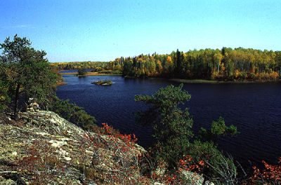 Turtle Lake
 Camping below Kettle Rapids
 Pillow Falls
 approaching the Granite Gates
 Kettle Rapids in low water, Apr 1994
 Kettle Rapids in low water
The upper portion of the Manigotagan is inside Nopiming Provincial Park. Most trips on the river start at Caribou Lodge, which is inside the park, and paddle mostly outside the park to highway 304. Just about everyone who has ever paddled the Manigotagan has come to the same conclusion -- the entire river really ought to be part of Nopiming Park, and this was apparently the original plan when Nopiming Park was created in 1976. See the map at the top of this page. The Manigotagan flows through a region where Abitibi held a logging licence for 60 years or more. Pressure from resource extraction companies apparently changed the proposed boundaries of the park.
"Advances" in logging techniques have now made possible destruction of the forest on a vast scale. See the photo below of a clearcut inside Nopiming Park, just a few miles south of Black Lake.
 A clearcut inside Nopiming Park, about 1994
About 1993(?), Abitibi sold the pulp mill at Pine Falls to the workers. Now it is being bought by another pulp and paper company that plans to expand it. A bridge was built over the Manigotagan downstream of Gem Lake in about 1995 to access the timber across the river. The current logging licence requires a buffer of 250 metres along the river corridor.
For more information on environmental concerns and the Manigotagan River, see the articles on the Manigotagan in Kanawa magazine, spring 1993, and Explore magazine, issue 72, apr/may, 1995.
The Manigotagan is a wilderness treasure for outdoor enthusiasts and paddlers, whether whitewater or flatwater. It is also a popular hunting area in the fall, abounding with wildlife. If the river corridor is given proper management, it can continue to thrill paddlers for generations to come.
 Go back to Bill Kocay's River Running Pages.